


My Whirlwind Trip to Ancash
Featuring civilizations thousands of years old, hikes totaling 6,600 feet of elevation, and the bluest water I’ve ever seen

Buckle in for a long post and lots of pictures! I recently took a vacation to the Ancash region of Peru and packed in as much activity as possible - including some of the most beautiful hikes in the world, archeological sites of civilizations that existed thousands of years ago, and some much needed quality time with my fellow volunteers.
Travel in Perú can be complicated to say the least. The Andes mountain range is enormous and difficult to traverse - at 8,900 kilometers long and an average height of 4,000 meters - making ground travel slow and not for those who easily fall motion sick. To give you an idea of the huge impact the mountains have on travel, the distance from Cajamarca, my department’s capital city, to Lima, the capital of Perú, is approximately 850 kilometers, and takes approximately an hour and twenty minutes on a flight (side note: a department in Perú is like a state in the USA). However, on a bus, this same route takes 16 hours. While, in theory, it would have been quick to take a flight from Cajamarca, the capital of Cajamarca, to Huaraz, the capital of Ancash, nearly all air travel in Peru is routed through Lima first. Thus, I began my journey to Ancash’s capital city of Huaraz with a 6 and a half hour bus ride from my department’s capital city of Cajamarca to the city of Trujillo, capital of neighboring department La Libertad. This included a decrease in elevation from 2,750 meters (8,900 ft) to sea level. While I was expecting to need some time to adjust to the higher elevation of Ancash, I hadn’t considered the way the massive drop in elevation would bother my ears and make my water bottle crumble!
Trujillo - Huaca del Sol y de la Luna
Taking advantage of the time before my next bus, I explored a bit of Perú’s second largest city. Perú has a long and fascinating history - with archeological sites several times older than the existence of the United States scattered across the entire country. I’ve had my eye on a handful of the archeological sites in Trujillo for a while, but with only enough time for one, I opted to visit the Huacas de los Moches, also known as Huaca del Sol y de la Luna (Huaca of the Sun and of the Moon). The word "huaca” comes from Quechua, an indigenous Peruvian language, and indicates a sacred place, either man-made or naturally occurring. Huaca can be translated to effectively mean “temple” or “shrine”. Many huacas, especially ancient ones that are preserved until today, take advantage of natural structures like caves or mountains to support an important structure. Archeologists believe that the two huacas outside of Trujillo were the capital of the Moche civilization, which spanned from the 1st century BC to the 9th century AD. The adobe structures suffered damage from the elements before being covered by sand and dirt, preserving them until being rediscovered in 1899, with excavation efforts still ongoing today. With this being such an old civilization with no written records available, there is still so much scholarship, excavation, and preservation work ongoing. The University of Trujillo’s archeology students and faculty collaborate often with the Ministry of Culture to research and preserve the site - imagine having such a rich opportunity for practical archeology experience a stone’s throw from your campus!
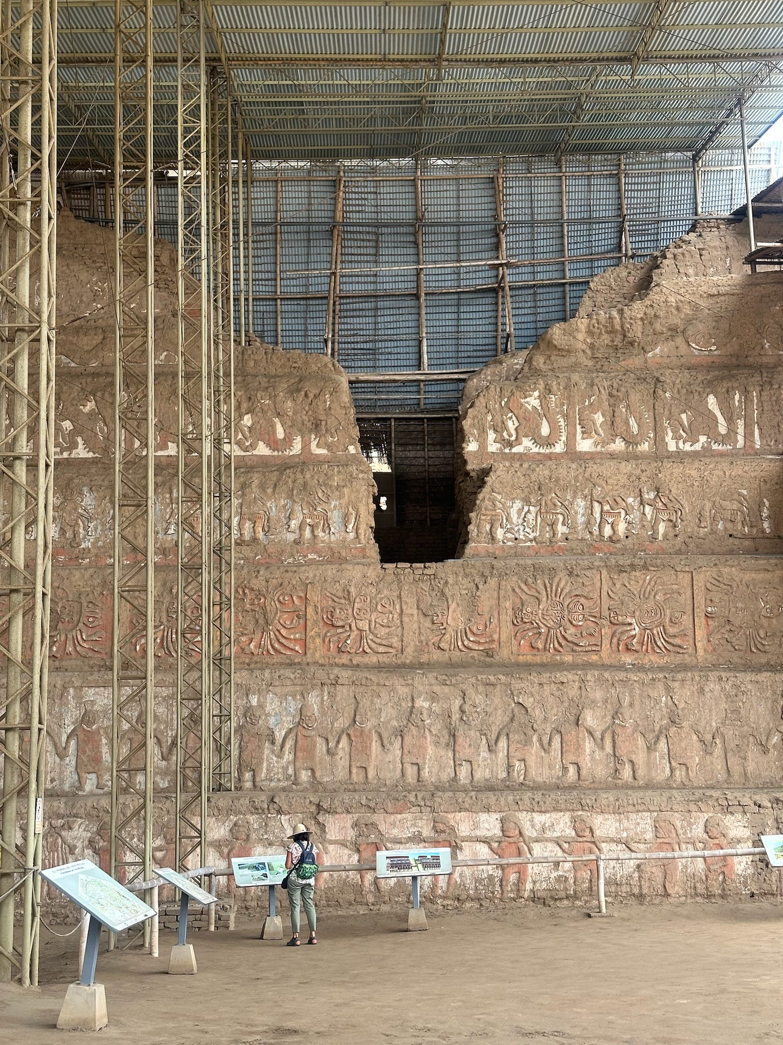
These structures are both absolutely staggering in size - it’s estimated that Huaca del Sol alone was once comprised of over 130 MILLION adobe bricks - especially when you consider how much of the height was likely lost to weather and time. Archeologists have been able to determine that the huacas were continually constructed upon for hundreds of years, with more levels and additions being added by each generation - this is visibly evident with changing art styles and depictions of deities and less visibly evident from changing composition of the bricks used for construction. While Huaca del Sol was used for administrative and government purposes, there is evidence that Huaca de la Luna was used for religious purposes, including human sacrifice.

My favorite part of the tour was Plaza 1, including a huge wall facade, which spanned several stories and was accompanied by a smaller, very detailed mural. The degree of preservation of the colors in the works of art was especially astonishing to me. The smaller mural - which spans 200 square meters - depicted a variety of people, deities, warriors, and animals. It’s been photographed in super high definition by National Geographic if you’d like to see it up close with some accompanying labeling and explanation. The huge wall facade mural stretches up several stories, with seven rows, each portraying a different repeated image. On a facade across from the main seven-story facade, soldiers are depicted wearing tall hats. The subjects for human sacrifice were chosen through a ceremonial mock-battle between the Moche soldiers in which the person who had their hat knocked off their head first was designated as the sacrifice. The seven-level facade includes images of ceremonial dancers, a ceremonial progression of soldiers with prisoners, very elaborate spiders, condors, and serpents. There are several different theories about the exact meaning of these various images and their significance, though most agree that imagery in the Moche civilization consisted of a lot of duality - like sky and sea, sea and land, and life and afterlife.
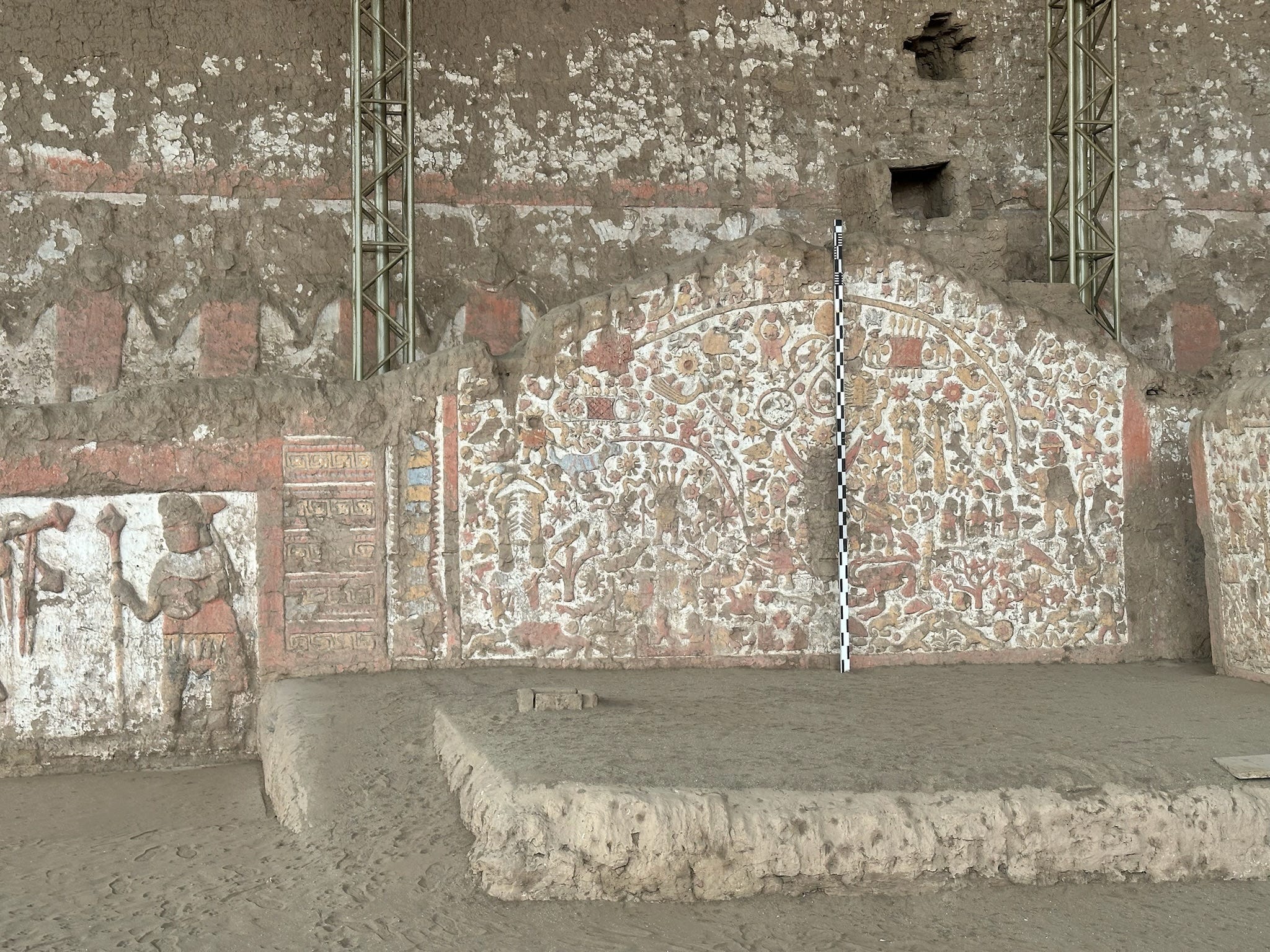

After the guided tour of the huacas, I explored the onsite museum, which houses a remarkable collection of artifacts. The artifacts range from vases, instruments, religious works of art, and dishes. The museum also does a great job of showcasing and explaining different common imagery used by the Moche civilization - many of the museum placards were even in English alongside the Spanish!


At this point, I hadn’t even made it to the primary target of my trip, and I was already having an incredible time getting to see more of Perú! From Trujillo, I embarked on my second and final leg to Huaraz on an 8 hour bus ride, ascending from sea level to 3,050 meters. Once in Huaraz, I joyously reunited with a handful of my fellow volunteers! It is always such a pleasure to spend time with other volunteers - to celebrate each other’s victories, to commiserate about missing home and family and American ketchup, and to revel in being able to express ourselves fully in English. Taking trips like this also allows me to expand my Peace Corps circle by meeting volunteers in other cohorts who serve in different regions!
Being conscious of the hikes ahead of us, we took our first day easy in Huaraz, letting ourselves adjust to the altitude and getting to know the city by shopping for souvenirs. Tourism is a massive industry in Huaraz, with the city seeing over 40,000 international tourists every year - the vast majority of whom are there to hike in Huascaran National Park. This meant opportunities to buy souvenirs presented themselves every 5 steps, but we were thankfully accompanied by a volunteer who lives in Ancash who showed us all the best spots to shop (and eat!).

Lake 1: Laguna Rocotuyoc and Laguna Congelada
On our second day in the city, we started our hiking adventures in earnest! The tour we booked picked us up at our hostel at 8:30 am to begin our trip to two of the over 300 glacial lakes (lagunas) in the 840,000 acres of Huascaran National Park - Laguna Rocotuyoc, also called Laguna Paccharuri (Hidden Waterfall in Quechua) and Laguna Congelada (Frozen Lake). The bus stopped to let us check out a gorgeous waterfall before taking us just a short hike away from Lake Rocotuyoc. This was the first glacial lake I’d ever seen and I could not BELIEVE the bright turquiose color of the water. It was not a color I had ever seen in nature before. The vibrant turquiose color is due to a combination of factors, including the mineral rich glacial waters that feed the lakes and reflect bright blue light, the cold temperatures that prevent algae from growing, and something called “glacial dust” - a fine mineral rich dust created from the friction of glaciers moving down mountain slopes that reflect and scatter light on the water.


We then hiked around the perimeter of Rocotuyoc to arrive at Lake Congelada, which was somehow, unbelievably, even more blue than Rocotuyoc. While this was far from our most demanding hike of the trip, we did get rained on for a portion of the hike - which was brutally cold, but still worth it! We all enjoyed some delicious and well earned peanut butter and jelly sandwiches while taking in the beautiful views.

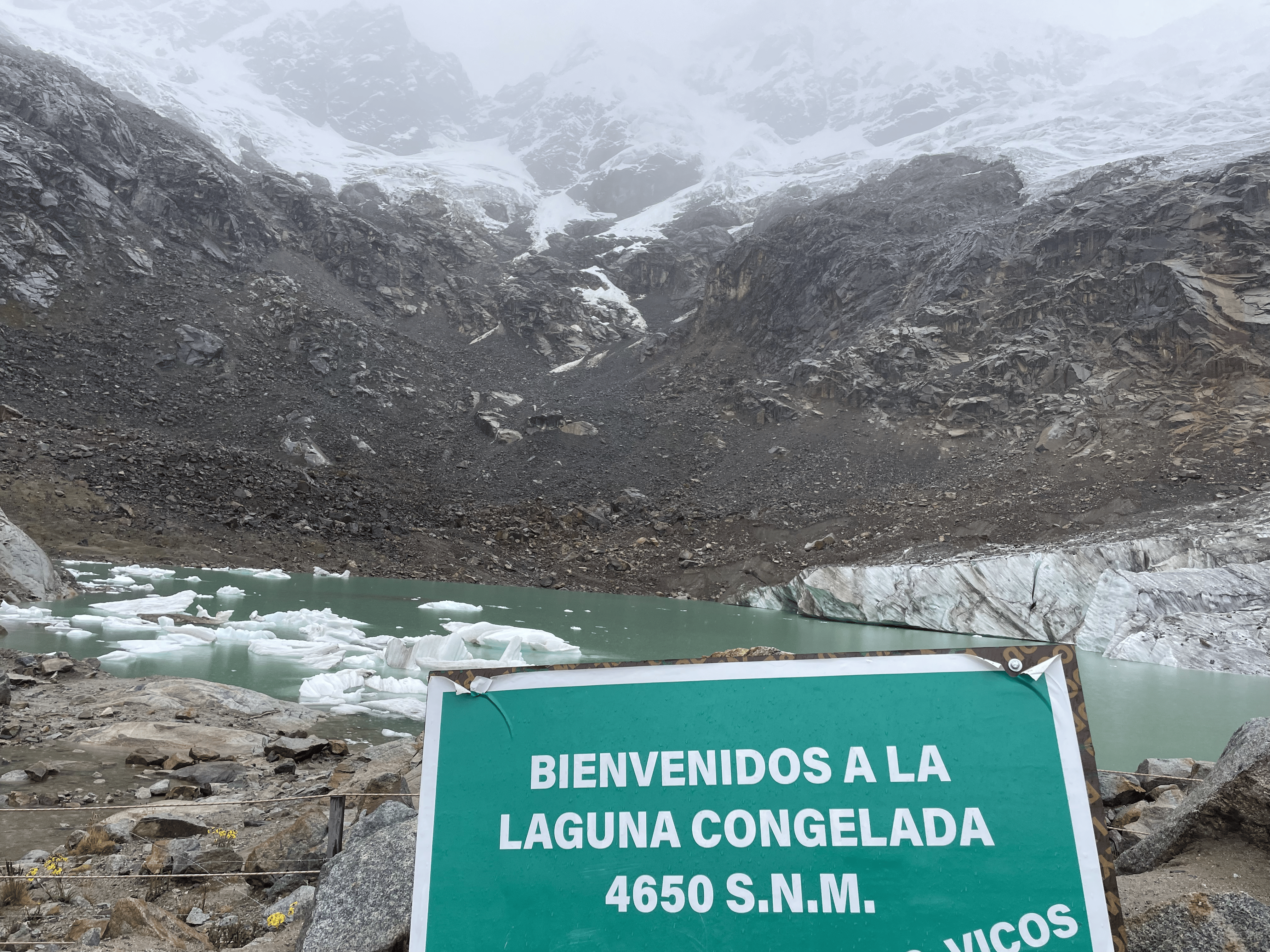


Hike Stats: About an hour to Lake Congelada (including many stops for pictures), 1.8 miles, 442 feet of elevation gain
Lake 2: Laguna Parón
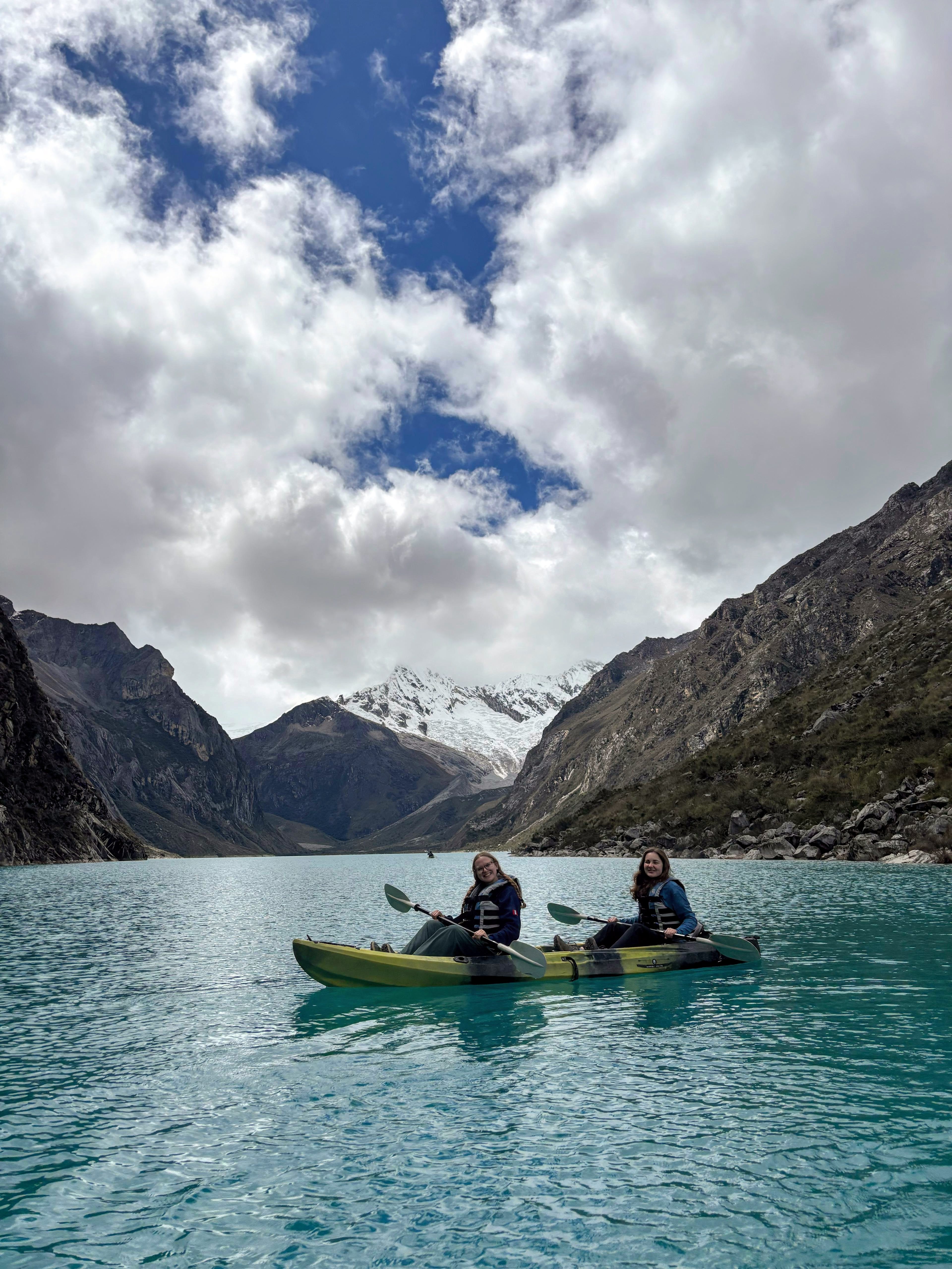
Our next day we had another hike planned, this time to Laguna Parón - the largest lake in the Huascaran National Park. We started our day getting picked up at at 5:30 am and driving over 4 hours to the trailhead, which included some truly brutal mountainous switchbacks - thank god for dramamine! At the trailhead, we traversed a rocky path up to a look out that towered over the 2.3 miles long lake. We basked in the views, enjoyed more peanut butter and jelly sandwiches, and snapped a ton of pictures. After hiking down from the viewing point to the shore of the lake, we had the chance to kayak on the lake! It was like being dropped directly into the most stunning postcard you’ve ever seen. As an added plus, the kayaking gave us a chance to use our arms after so much hiking! I’d try to describe the insane view of the brilliantly blue lake framed by the immense snowy mountains, but I really could never do it justice. Enjoy the pictures below!
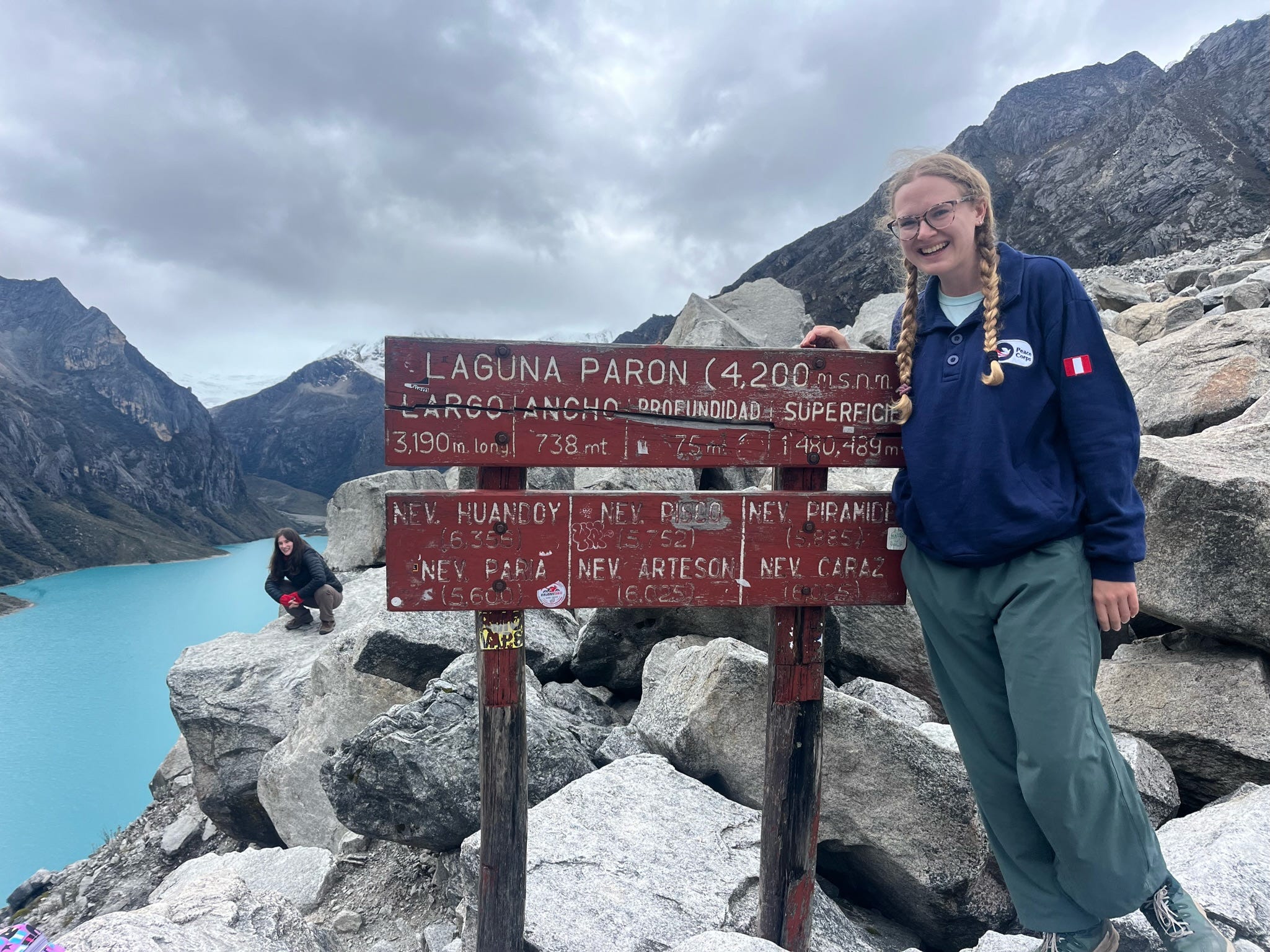

Hike Stats (to the lookout): About an hour, 1.1 miles, 475 ft of elevation gain
Chavín de Huántar: Archeological Site & Museum
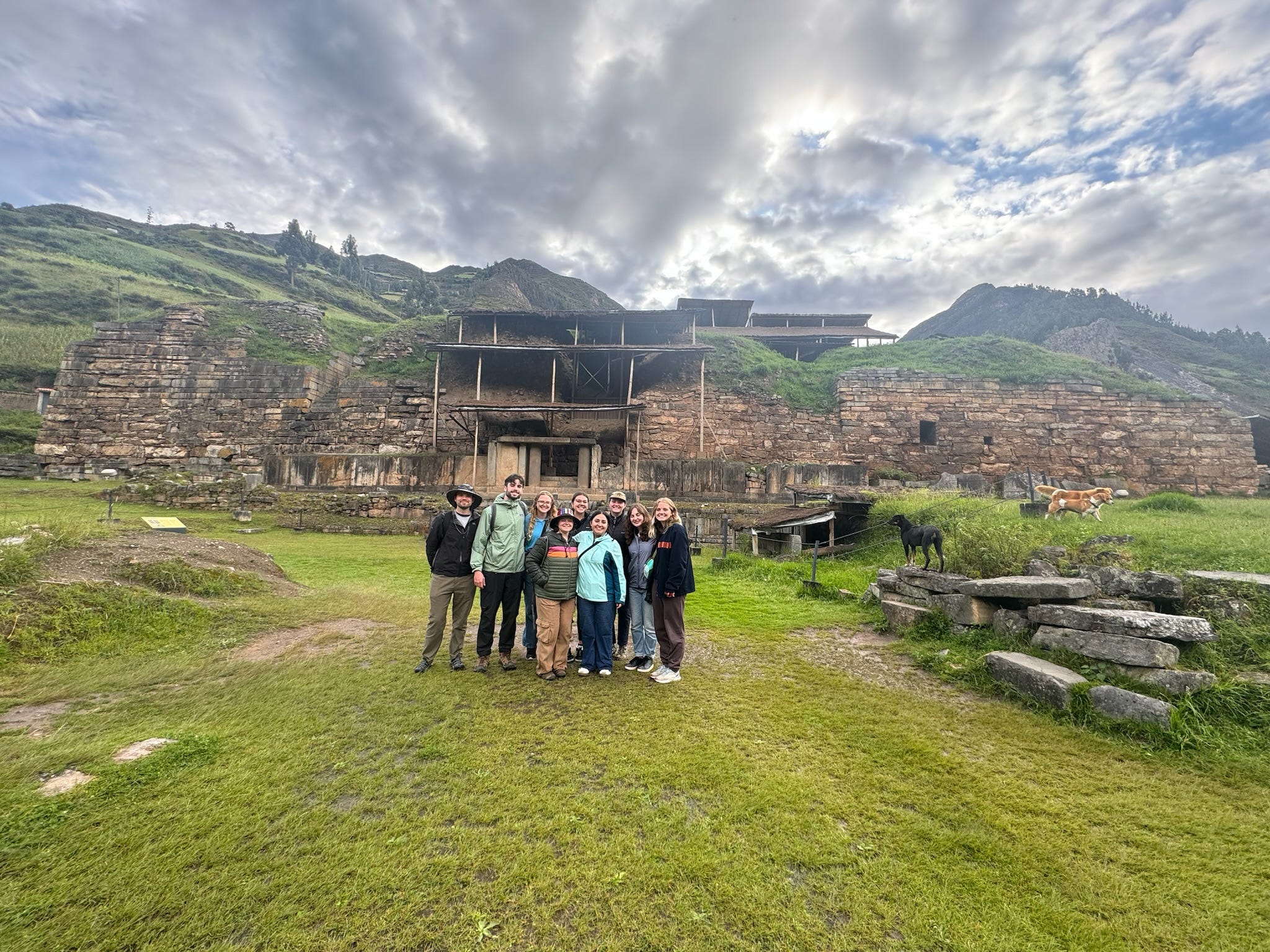
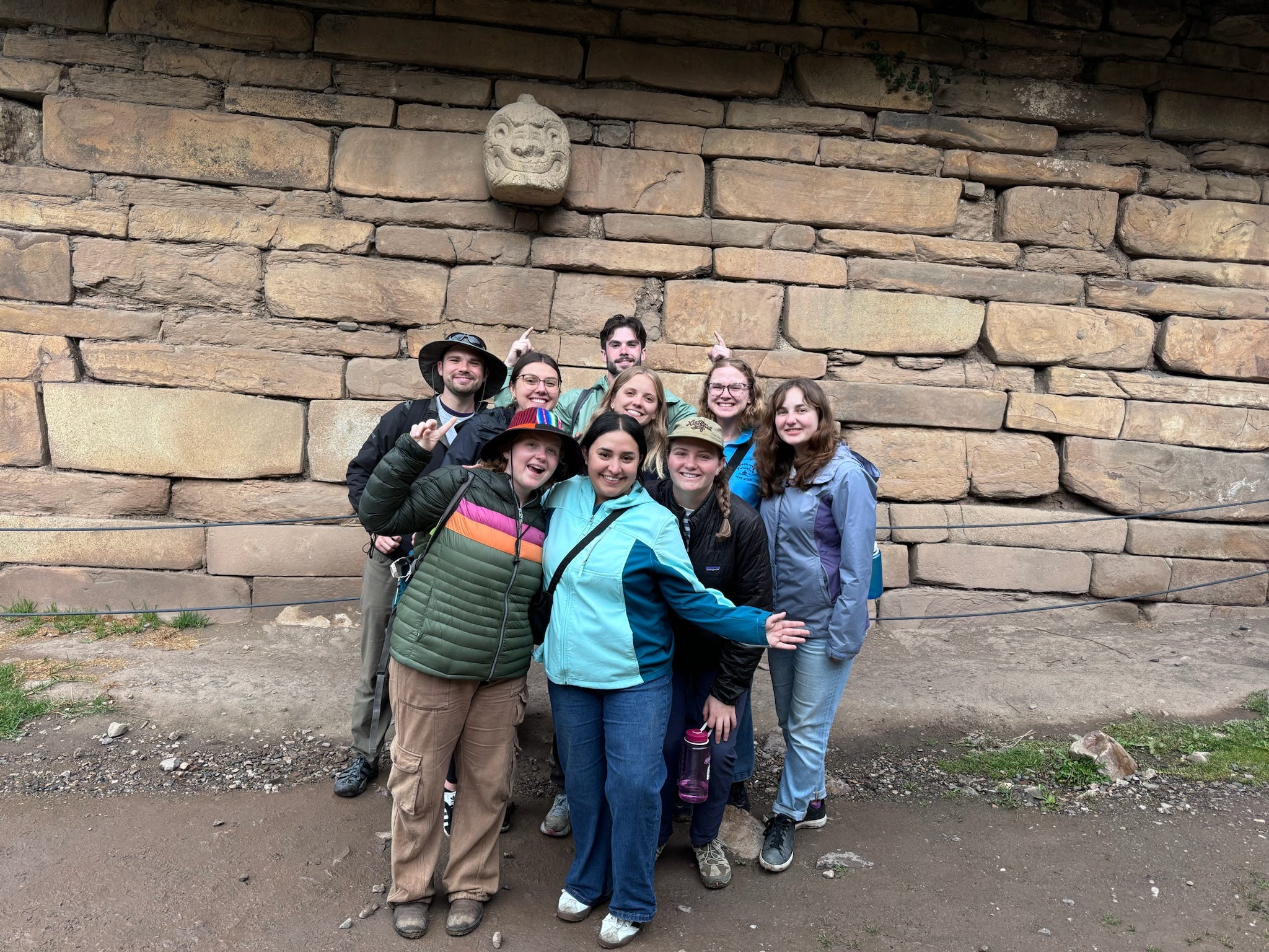
The next day of our trip, we took a break from hiking and traveled out of Huaraz to Chavín de Huántar. Located about 2 and a half hours outside of the capital, Chavín de Huántar is small town hosting an archeological site of major historical importance. Designated as a UNESCO World Heritage Site, construction on the Chavín de Huántar temple started before 1200 BC and originally served as a ceremonial center for the Chavín civilization. The Chavín were a major pre-Incan civilization with influence spanning across the Peruvian coast and into the highlands. The temple, which sits at the conjunction of two rivers, is the civilization’s crowning architectural achievement as well as a site of great religious significance to the Chavín. People from all across the vast Chavín civilization went on long pilgrimages across the mountains to come worship, consult oracles, and conduct rituals. This is evidenced by the array of artifacts unearthed at the temple, which includes a variety of seashell art that were brought from the coast.

My volunteer friend Mackenzie lives and works in Chavín de Huántar - talk about an awesome place to live as a Peace Corps volunteer! In addition to her work as a health volunteer, she works with the tourism department at the archeological site to improve their English language tour options. While visiting, we went on a special tour with one of her friends at the archeological site. The site hosts a huge stone temple as well as underground labyrinth, which houses rooms used for rituals and oracle meetings. The many pilgrimages to Chavín de Huántar led to the proliferation of influence of Chavín style art throughout pre-Incan Perú. As a matter of fact, while doing additional research for this blog post, I came across a wealth of art history sources and platforms discussing the art found at Chavín de Huántar!
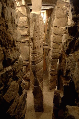
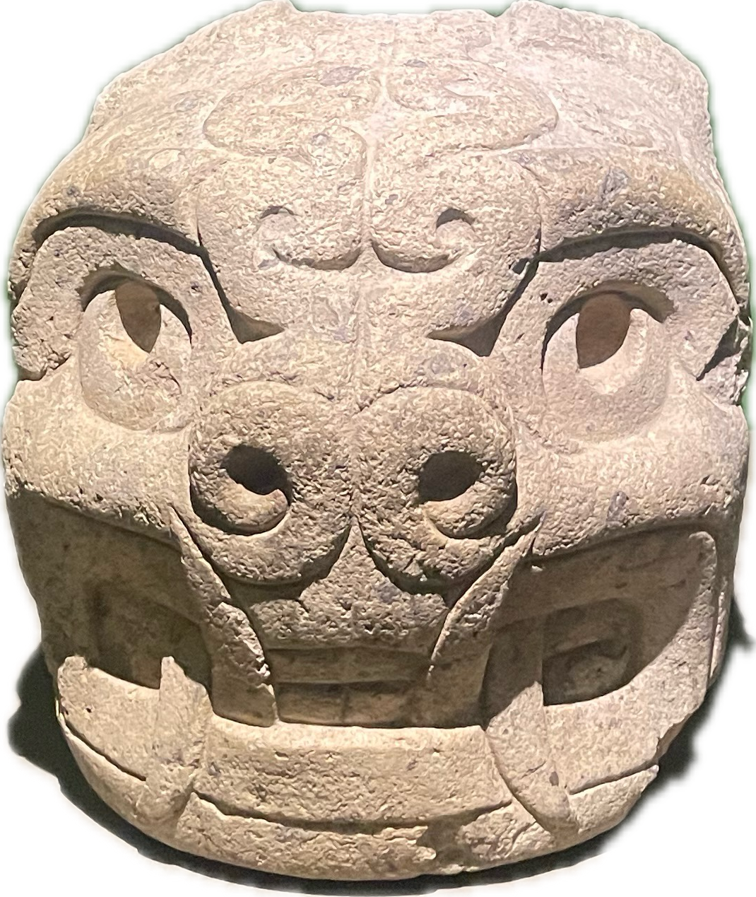
While there are many examples of impressive carved stone art throughout the site and the accompanying museum, the most iconic works of art are the “lanzón” and the “cabezas clavas.” The lanzón, or lance, is a knife shaped sculpture that depicts an anthropomorphic figure with feline and serpent features and is housed in the underground labryinths. The disorienting twisting hallways, combined with the hallucinogenic San Pedro cactus that was often involved in rituals, contributed to an especially powerful religious experience for those present. The “cabezas clavas,” or nail heads, are stone sculptures depicting anthropomorphic transformation, often with either serpent, feline, or bird features. Each head has a protrusion on the back, that was originally used to insert it into the construction of walls and is the origin of the name “nail heads.” One cabeza clava can be seen on the tour of the site, while the museum hosts about 100 others. It was especially neat to explore this site after my exploration of Huaca del Sol y de la Luna, seeing the influences of different imagery across civilizations and time.
…and a small sample of some of my favorite cabezas clavas on display in the museum!


Chavín de Huántar: 13k
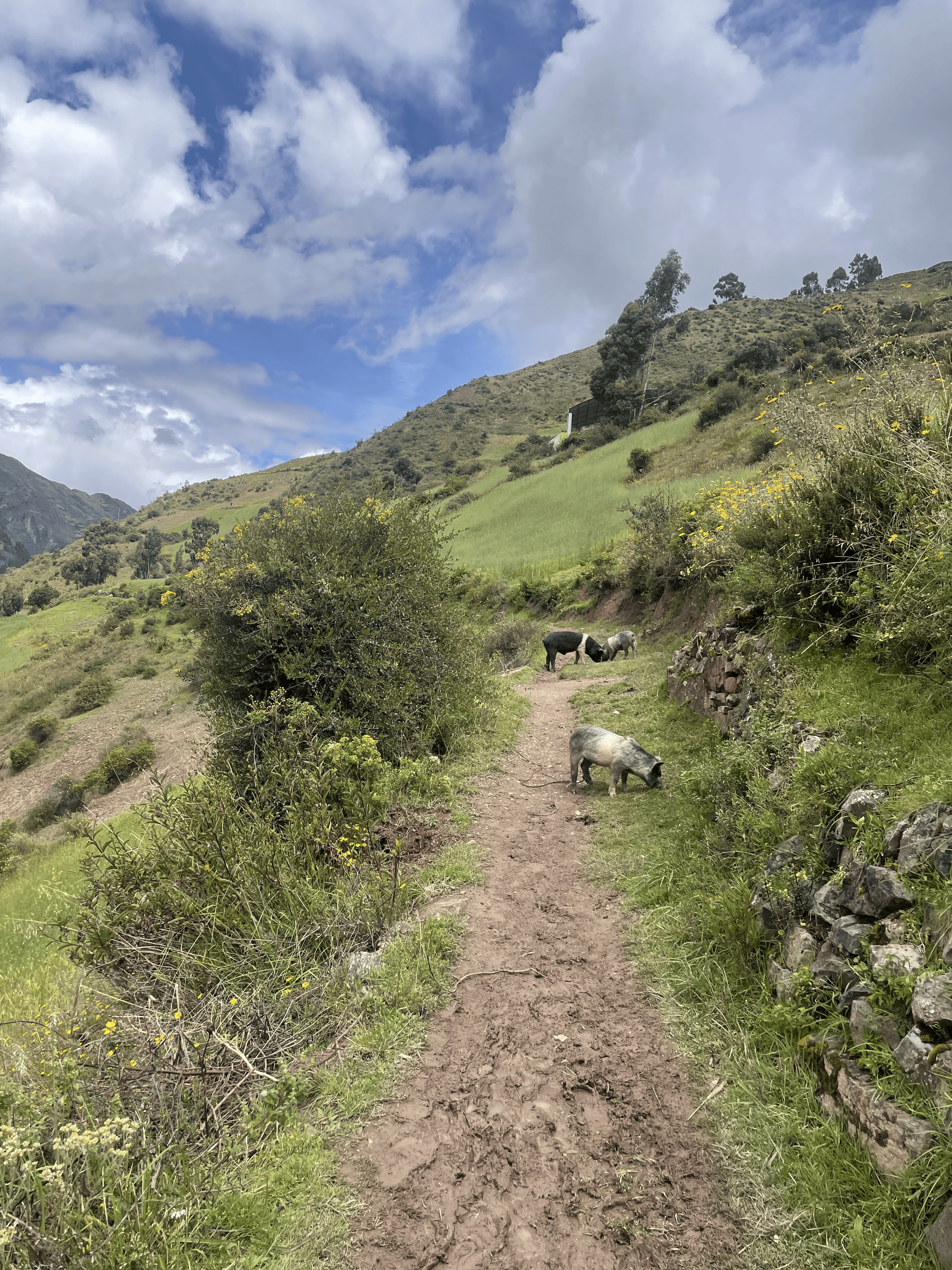
After our physically restful and intelectually stimulating day at the archeological site, I had a long day ahead of me. I woke up early with a few of the other girls from our group, had a good breakfast of chicken on a roll, slathered on some sunscreen, and lined up for a 13 kilometer (7.9 mile) trail race around Chavín de Huántar. I am by no means a runner, serious or amateur, but I was convinced to sign up for this race for the beautiful mountain views and the included t-shirt. I’m glad I went into the race totally blind, because if I had fully known and understood what I was in for, I probably wouldn’t have followed through on it. This trail was wildly difficult and very rugged, with just about 3,000 feet of elevation gained and lost over the course of it - more than any of the mountainous hikes of the trip! There were points where the trail went nearly straight up and I had to use my hands to help my ascent, a point where I had to negotiate my way past a gaggle of pigs, points where I was a few feet from falling off a precipitous mountainside, and lots and lots of mud. Regardless of the rugged trail, the views were absolutely stunning. I had no reservations about stopping to catch my breath and snap a picture throughout the course of the race. The set up of the trail had the first half as mostly incline and the second half as mostly decline - which presented its own challenges, as the declines were muddy and slippery when on dirt or slick and slippery when on paved roads. I surprised myself by having a really great time and may even sign up for another race later this year in the Peruvian rainforest! It turns out running is much more enjoyable when you have a jawdropping backdrop.

Lake 3: Laguna 69
You’d think that after a very physically taxing trail race that I would take it easy on my last day back in Huaraz. Alas, life - and vacation - is short and I had yet to embark on one of the most well-known day hikes in Huascaran National Park: Laguna 69. While the area was being designated as a national park, a list of all the lakes in the park was created, with unnamed lakes receiving numbered names. I was getting a little nervous on the bus ride to the trail head, as the guide was giving us a spiel we hadn’t received before our previous hikes. He stressed the importance of keeping up a steady pace, especially at the beginning. It’s vital to cover a lot of ground relatively fast at the get-go, as the trail starts out somewhat flat, and you need the bulk of the allotted time to cover the second half. He also told us that he would not hesitate to tell people if they were off-pace and would advise some people to turn back if he didn’t think they’d make it to the lake and back under our strict time constraints.
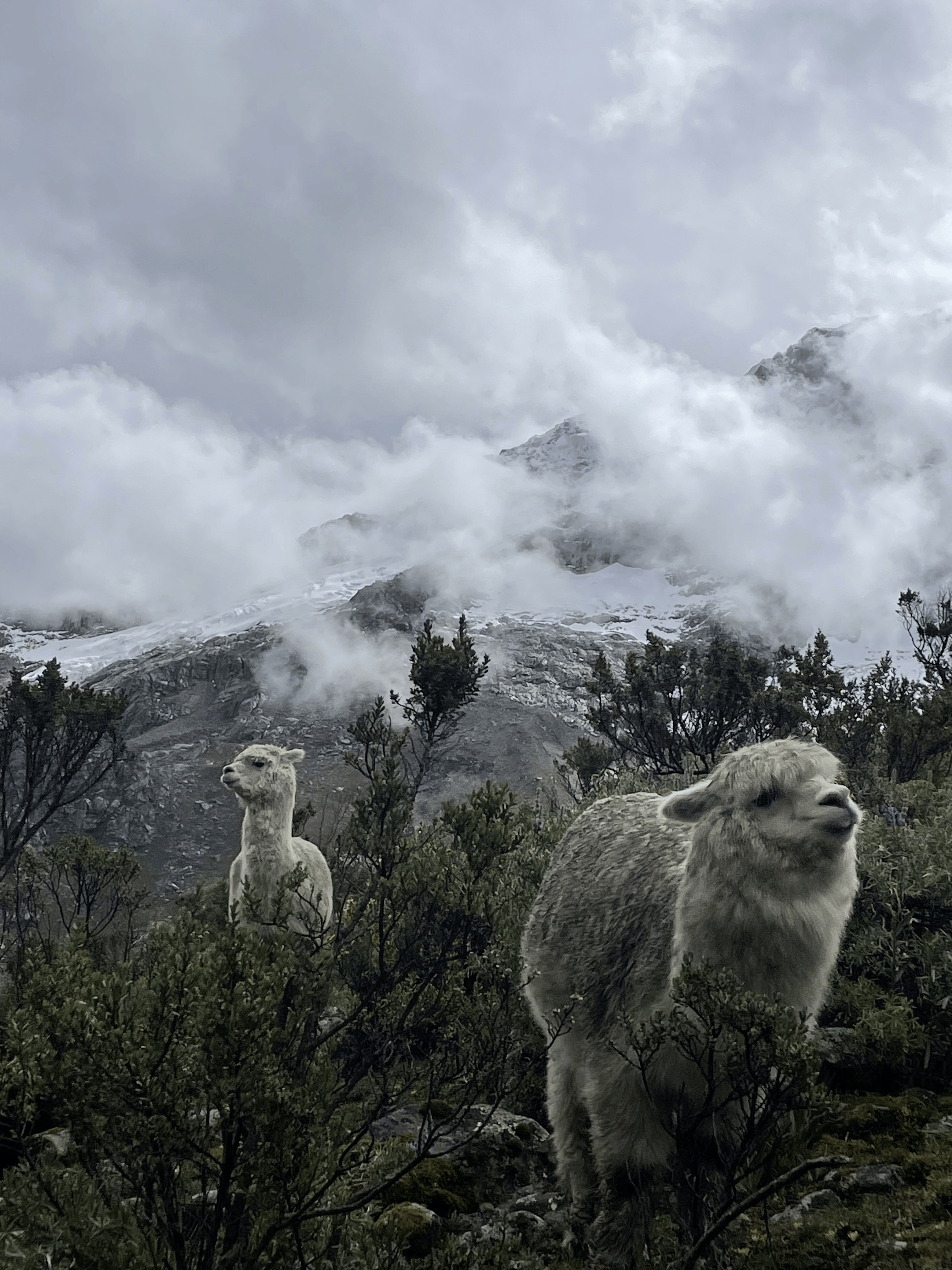
Throughout this hike, we learned that our guide was not joking around in the slightest. The final leg of the hike was grueling - a combination of a very steep trail, the increasingly thin air, and our bodies already sore from the endeavors of the past couple days. Luckily there was no shortage of nature to marvel as we huffed and puffed our way to the top - including a small lake, a massive waterfall, and a myriad of grazing cows. We managed to keep up a perfect target pace, a frozen tear nearly coming to my eye when we reached the lake in just under 3 hours. Our pace allowed us a full hour to enjoy the lake, take lots of pictures, and eat more peanut butter and jelly sandwiches. The bright blue lake was beautifully framed by the glacier that feeds it overhead. While basking in the view of the lake and our hiking feat, it even started snowing - my first time seeing snow in Perú!

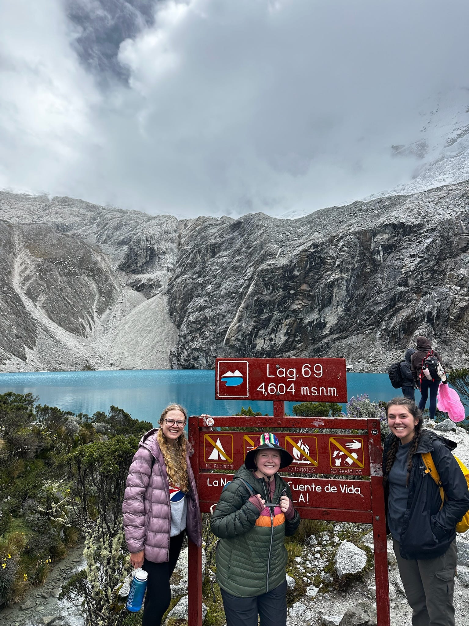
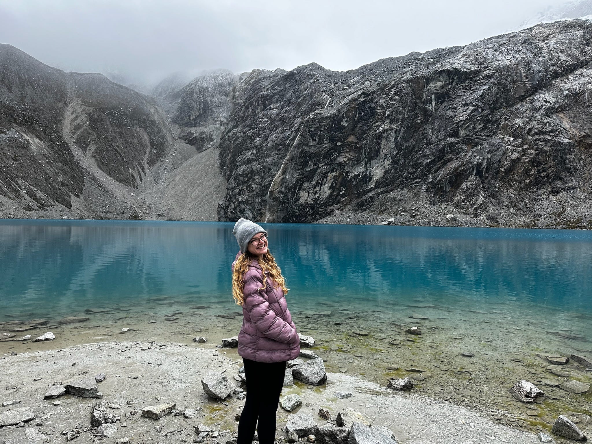

Hike Stats: 3 hours up + 2 hours back, 8.1 miles, 2,696 feet of elevation gained
Ending this trip with back-to-back 8 mile run and 8 mile hike was certainly not my most well-planned out endeavor, though it was totally worth the soreness - and with my journey home beginning in the night after our Laguna 69 hike, I knew my legs would have lots of time to recover on the long bus rides.
I am so grateful to live in such a beautiful country with such varied landscapes, and I feel especially lucky to have so many lovely and adventurous friends to share this experience with! Getting to see more of the country where I live helps me better understand the culture and history of the community that I serve. The opportunity to fully immerse myself into another culture is so unique and not something that would be possible for me without Peace Corps. With my remaining 18 months of service, there are plenty more sites in Perú I hope to explore, so stay tuned for my next adventure!
i'm realizing i never commented on this post but i just read it again and i had to come back to say i am so amazed by you!!!! i cannot believe you did that race lol I could never. and i am so jealous of everyone who gets to go on these adventures with you!!
Wow! Thanks for sharing. So beautiful. And the history is mind boggling.